موارد

This package includes 3 maps pertaining to Lebanon's 2009 elections: - "confessional-distrib": showing the confessional geographic distribution of Lebanon's population - "election-results": showing

Maps of businesses open in Nahr El Bared's adjacent area including food production businesses, construction and hardware industries, beauty and entertainment enterprises, and health, education and

This Map contains the following information layers: - Political Layer displaying the electoral weight of each of the opposition and the loyalists in each of the electoral districts of the 2005 Gene
Maps showing the distribution of development projects in various fields including health, education, agriculture, etc.
This package includes two documents: - "UNICEF_Activities_22_08_06": mapping of UNICEF aid distribution activities in Lebanon, up to 22 August 2006 - "UNICEF_Distributions_Aug_21_06": mapping of UN
Maps showing the distribution of development projects in various fields including health, education, agriculture, etc.
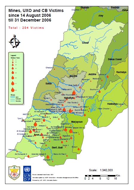
Shows number of victims per town

This Map Contains The Following Information Layers: - Political Layer displaying the electoral weight of each of the opposition and the loyalists in each of the electoral districts of the 2005 Gene